How to find land zoned for multifamily with AI
800 buildable infill sites across Connecticut, ranked.

Brennen Fountain
To find land zoned for multifamily, you need two things side by side: parcels, with their size, shape, and current use, and a zoning map that says which districts allow three- and four-family or larger buildings. Connecticut has 169 towns, each with its own zoning code, so the second part is the hard one. An AI assistant such as Claude or ChatGPT can filter and rank parcels against those rules once both are in one place, but it cannot assemble 169 towns of zoning on its own.
A multifamily builder focused on small infill buildings wanted to know where in Connecticut they could actually go. The ask was short:
Find parcels that would be prime candidates for [our] buildings. Square or rectangular sites work best.
The problem: 169 towns, 169 zoning codes
Infill multifamily lives or dies on sites that conventional projects pass over: a one-acre vacant lot near a downtown, an underused parking lot, a leftover commercial pad. Those sites exist in every town. The question is which of them allow a building with dozens of units.
That answer is in zoning, and in Connecticut zoning is set town by town. Each of the 169 municipalities has its own districts, its own codes, and its own rules for two-, three-, and four-plus-family housing, as of right, by special permit, or through an overlay. A parcel record shows a district code like "R-18" or "T-4"; what that code allows is in a separate ordinance for each town.
Checking that by hand for one town takes an afternoon. For a statewide search, it means reading 169 ordinances before you can rule out a single lot.
The result: 800 buildable sites, ranked
The builder ended up with 800 Connecticut infill parcels that fit their building: half an acre to five acres, rectangular enough for a building footprint, currently vacant or used for parking, in a district that permits three- or four-plus-family housing, and outside flood hazard areas. Each was scored for fit, with 35 rated prime and 94 strong or better, on a map and in a ranked table.
The funnel shows how much the zoning step does: 6,681 vacant or parking parcels of the right size, 3,935 of them a usable shape, only 907 in multifamily zoning, and 800 after removing flood zones.
Why an AI assistant can't do this on its own
AI assistants like Claude and ChatGPT increasingly act as agents: you give one a task in plain English and it researches, analyzes, and comes back with an answer. Give one parcels and a zoning map side by side and it can do this screen well, including the shape math. Getting there is the problem.
Ask an assistant which Connecticut parcels are zoned for multifamily and it will search the web, find a few town zoning pages and some news about the state's housing debate, and stop. It cannot read 169 zoning ordinances, it cannot load the state's parcels, and whatever it pieces together is gone when the conversation ends.
How it was done: Ploti
The builder used Ploti, the real estate data layer for AI. Ploti's data agents fetch and compile public records, from parcel layers to zoning maps and ordinances, and store them so an AI agent can query all of it. For this search the missing piece was a statewide answer to "which districts allow multifamily", and Ploti brought in the Connecticut Zoning Atlas: 2,297 zoning districts across all 169 towns, each with its housing permissions, ready about a day and a half after it was asked for.
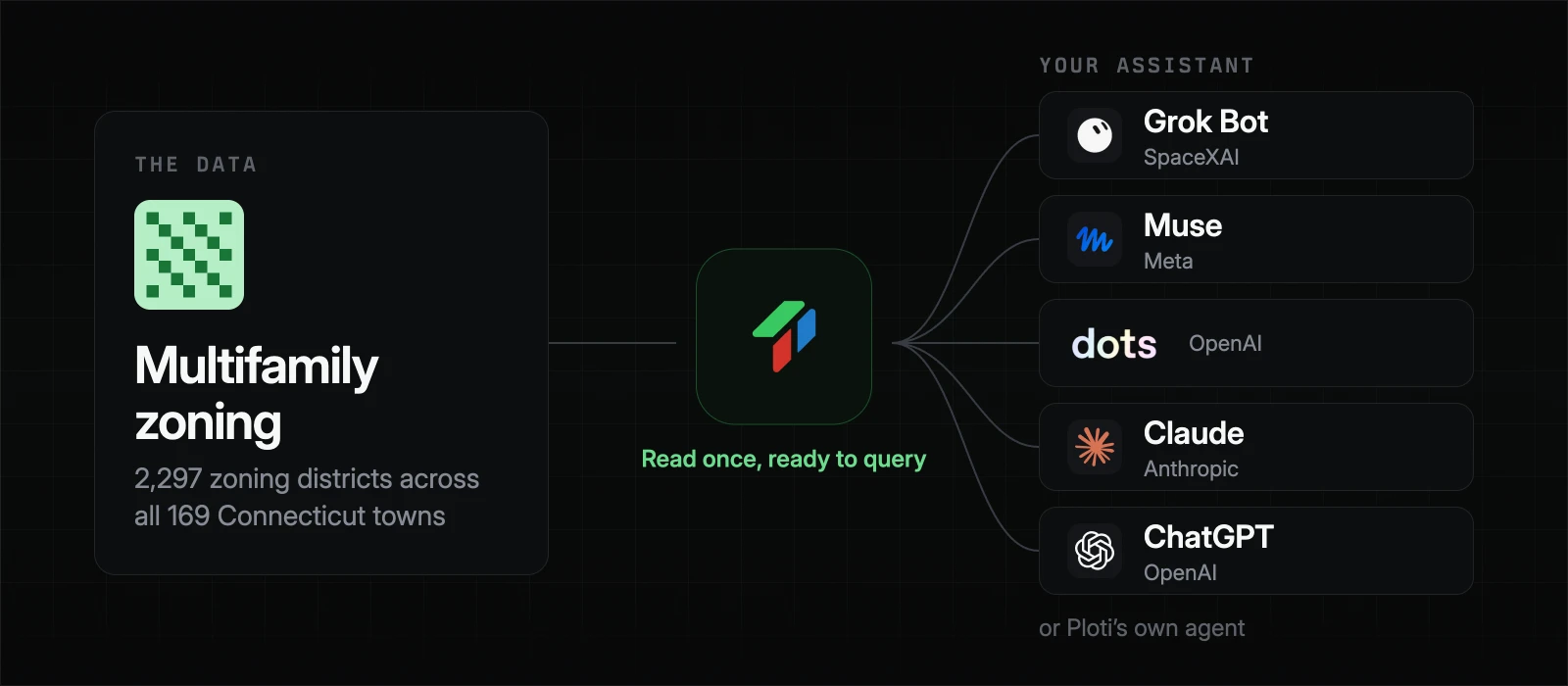
With zoning and parcels in one place, the rest was analysis Ploti's agent ran directly: filtering by size and use, measuring each parcel's shape, overlaying flood zones, and scoring every site. The data stays ready, so the builder's assistant can rerun the screen with a different unit count or a smaller minimum lot through an MCP connector in Claude or ChatGPT, or through Ploti's own agent.
When a town's rules are only in a scanned ordinance or not online at all, Ploti's agents can work through permit portals and meeting archives, and Ploti can email the town for the documents.
Why not buy zoning data from a data provider
Zoning databases exist, sold on annual contracts negotiated through sales, often in the tens of thousands of dollars, and priced by seat or lookup. Town-level housing permissions, the detail this search depended on, are often missing or out of date in them.
Ploti works differently:
- No contract. Sign up and start with a 7-day trial.
- Pay for the counties you build in. Pricing is per county and gets cheaper as you add more, so a statewide search costs hundreds of dollars a month, not an annual license.
- Full access in your counties. Your assistant can query every district, parcel, and rule in your coverage areas.
- It builds up over time. Ploti keeps collecting data in your counties on its own, so permits, rezonings, and meeting records are often already there for the next question.
What else it unlocks
The same data supports more than one decision:
- Site outreach. Turn the ranked list into owner outreach for the top sites, starting with vacant lots and parking lots.
- Approval path. Separate sites allowed as of right from those that need a special permit, and look at how similar requests fared in each town, as in how to find rezoning history with AI.
- Market priority. Combine fit scores with rents and demand to decide which towns to work first.
Anything your search needs that Ploti does not have yet, you can ask for as a data request.
Frequently asked questions
How do I find out if a parcel is zoned for multifamily?
Look up the parcel's zoning district on the town's zoning map, then check that district's permitted uses in the zoning ordinance for two-, three-, or four-plus-family housing, and whether it is allowed as of right, by special permit, or through an overlay.
Is there a statewide zoning map for Connecticut?
Yes. The Connecticut Zoning Atlas maps zoning districts in all 169 municipalities and records which housing types each district allows. Ploti has it as a queryable dataset of 2,297 districts.
What makes a good infill multifamily site?
Usually a vacant lot or parking lot of about half an acre to a few acres, a regular shape that fits a building footprint, zoning that allows the units you need, and no flood or wetland constraints.
Can an AI assistant search for multifamily sites?
Yes, once it can query parcels and zoning. Connect Claude, ChatGPT, or another assistant to Ploti with an MCP connector and ask for multifamily-zoned parcels that fit your size and shape, or ask Ploti's own agent.
How you can do it yourself
If you already use an assistant, connect Ploti and run your own site search. Setup takes about two minutes for Claude, ChatGPT, Gemini, Claude Code, Codex, and Cursor, and works with any assistant that supports MCP connectors. Then ask:
- "Find vacant parcels of one to three acres in districts that allow four-plus-family housing as of right."
- "Which of these sites are outside flood zones and within a mile of a downtown?"
- "Rank them by how many units fit at 40 units per acre."
If you don't use an assistant, ask Ploti's agent on the web, in the Mac or Windows app, or soon on your phone. Pick the counties you work in and start a 7-day trial.