How to find a cell tower site with AI
A 120-foot tower in a Chicago suburb: which parcels could get approved.

Brennen Fountain
Finding a cell tower site means matching three things: parcels big enough for the lease area plus the required setbacks, zoning districts where a tower of that height can be approved, and the local wireless telecommunications ordinance that sets heights, setbacks, and the approval process. Airports nearby and flood zones narrow it further. An AI assistant such as Claude or ChatGPT can screen parcels against those rules once they are in one place, but it cannot read a town's ordinance and parcel maps together on its own.
A wireless siting team needed a home for a new tower in a dense, built-out suburb of Chicago in Cook County, Illinois. The request was specific:
Looking for a parcel in [the village] to get zoning approval for a new 120' cell tower with a 50' x 50' lease area within the parcel.
The problem: a tower has to fit the rules and the lot
Coverage gaps in dense suburbs are hard to close, and the parcel is usually the constraint. A 120-foot tower needs more than a 50-by-50-foot lease area: it needs a district where a tower that tall can be approved, setbacks from property lines and nearby homes that many ordinances tie to the tower's height, access for crews, and power. Near airports and heliports, height can also trigger federal review.
Each of those answers is in a different place. Parcel boundaries and lot sizes are in the county's records, the district map and the wireless telecommunications ordinance are on the village's site, and aviation facilities and flood zones come from federal sources. A siting specialist pieces them together parcel by parcel.
In a built-out village of small lots, that means ruling out hundreds of parcels by hand before the few real candidates appear.
The result: the parcels that could actually work
The team ended up with the village's parcels, its zoning districts, and its tower rules in one place, and from them a short list of parcels where a 120-foot tower could be approved: in a district that allows it, large enough for the 50-by-50-foot lease area plus the required setbacks, with the approval path for each, whether administrative or a public hearing.
Nearby airports and heliports, flood zones, and power lines were checked against every candidate, so the list was ready for landlord outreach rather than another round of desk research.
Why an AI assistant can't do this on its own
AI assistants like Claude and ChatGPT are increasingly used as agents: you describe a task in plain English and they research it, reason through it, and report back. Give one an ordinance and a parcel table and it can apply setback rules well. Assembling those inputs is where it falls short.
Ask an assistant where a 120-foot tower could go in a given suburb and it will search the web, maybe find the village's zoning code, and summarize the tower section. It cannot load the county's parcels, measure which lots can hold a lease area plus setbacks, or keep any of it for the next site. It will often answer confidently anyway.
How it was done: Ploti
The team asked Ploti, the real estate data layer for AI. Ploti's data agents fetch and compile public records from local governments, parcels, zoning maps, and the ordinances behind them, together with state and federal layers, and store them so an AI agent can query all of it. For this request they brought together Cook County's parcels for the village, its zoning districts, and its wireless telecommunications rules, alongside the federal aviation, flood, and power data already in Ploti.
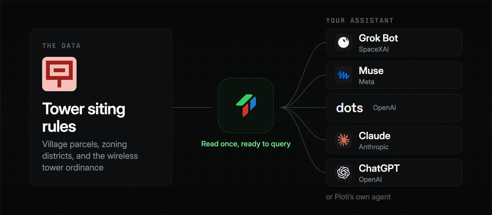
That work was done once. The team's assistant can now rerun the screen for a shorter tower, a different lease size, or the next village over, through an MCP connector in Claude or ChatGPT, or through Ploti's own agent.
When a town keeps its ordinance only as a scanned document or not online at all, Ploti can email the clerk for it, and the same agents work through permit portals and meeting archives to see how past tower applications were decided.
Why not buy siting data from a data provider
Tower siting teams often license parcel and zoning data from national providers on annual contracts, often in the tens of thousands of dollars, priced by seat or lookup. The rules that decide a tower site, the local wireless ordinance with its heights and setbacks, are rarely part of what those products sell.
Ploti works differently:
- No contract. Sign up and start with a 7-day trial.
- Pay for the counties you site in. Pricing is per county, starting at $50 a month, so Cook County on its own costs tens of dollars a month.
- Full access in your counties. Your assistant can query every parcel, district, and rule in your coverage areas.
- It builds up over time. Ploti keeps collecting data in your counties on its own, so the next town's zoning is often ready before you ask.
What else it unlocks
The same data supports more than one site:
- Search rings. Screen every parcel inside an RF search ring at once instead of driving it.
- Approval risk. Separate administrative approvals from sites that need a hearing, and read how the board ruled on past tower requests.
- Small cells and collocation. Pair zoning with existing structures and rights of way to find places where a new tower is not needed at all.
For how zoning comes together across many towns, see how to find county zoning maps with AI. Anything your siting needs that Ploti does not have yet, you can ask for as a data request.
Frequently asked questions
Where are cell towers allowed by zoning?
It depends on the town. Most have a wireless telecommunications section in the zoning ordinance that lists the districts where towers are allowed, the maximum heights, setbacks from property lines and homes, and whether approval is administrative or needs a public hearing.
How much land does a cell tower need?
The lease area is often around 50 by 50 feet, but the parcel usually has to be larger because of setbacks, which many ordinances tie to the tower's height, plus room for access and utilities.
Do cell towers need FAA review?
Tall structures near airports and heliports can require FAA notice, so siting usually checks the distance to nearby aviation facilities along with local zoning.
Can an AI assistant find cell tower sites?
Yes, once it can query parcels, zoning, and the tower ordinance. Connect Claude, ChatGPT, or another assistant to Ploti with an MCP connector and ask which parcels could support a tower of a given height, or ask Ploti's own agent.
How you can do it yourself
If you already use an assistant, connect Ploti and screen your own search rings. Setup takes about two minutes for Claude, ChatGPT, Gemini, Claude Code, Codex, and Cursor, and works with any assistant that supports MCP connectors. Then ask:
- "Which parcels in this village could fit a 50 by 50 foot lease area with setbacks equal to a 120-foot tower's height?"
- "In which zoning districts can a new tower be approved administratively?"
- "Are any of these parcels within two miles of an airport or heliport?"
If you don't use an assistant, ask Ploti's agent on the web, in the Mac or Windows app, or soon on your phone. Pick the counties you work in and start a 7-day trial.