How to find county zoning maps with AI
Zoning for 15 counties, most of it ready within an hour.

Brennen Fountain
Zoning is set by each county for its unincorporated land and by each city or town for its own, so one county can have a dozen or more zoning maps spread across separate websites, map servers, and PDFs. Finding them means checking the county's planning or GIS department and then every municipality inside it. An AI assistant such as Claude or ChatGPT can screen land against those maps once they are collected in one place, but on its own it tends to find the county's map and miss the towns.
A land investor sat down one Sunday evening with 25 counties across ten states and asked for the same things in each one: zoning, utility lines, and tax delinquency. The zoning ask was one line per county:
County and municipal zoning districts, for buildability and infill-vs-rural lot classification.
The problem: a county is rarely one zoning map
For a land investor, zoning is the first filter. It says what can be built, how small a lot can be, and whether a parcel reads as infill or rural. Screening more counties than the next buyer is a real edge, and that screen starts with zoning in every one of them.
But a county usually has more than one zoning map. The county zones its unincorporated land, and each city and town zones its own. In one coastal North Carolina county in this request, that meant the county plus 19 towns: 20 separate maps. A Florida county on the list had six. Each lives on its own website, map server, or PDF, and some are not linked anywhere a person would look.
Across the 15 counties covered here there were 56 zoning datasets to find. At an hour each to track down, download, and confirm it is current, that is about seven working days before you screen a single parcel, and this investor had 25 counties.
The result: 15 counties of zoning by the next morning
By the next morning, zoning for 15 of the 25 counties was ready: 56 zoning datasets across seven states, county and town maps alike, each linked to the government that publishes it. 11 of those counties were ready within about an hour of asking. The slowest took just under 13 hours, for a New Mexico county whose zoning had to be tracked down.
Instead of a week of collecting maps, the investor could start sorting land the same night: which lots sit in town districts and which are rural, which districts allow the uses they want, and which counties are worth a closer look. The maps stay in place for the next question.
Why an AI assistant can't do this on its own
AI assistants like Claude and ChatGPT now work as agents: you describe a task in plain English and they go research it, analyze what they find, and report back. Give one a list of parcels and a zoning map and it does well. Ask it to go get the zoning maps, and it runs into trouble.
Asked for zoning across 15 counties, an assistant searches the web, often finds each county's main zoning page, and misses most of the towns. It cannot reliably pull a full layer from a county map server, a map published as a PDF gives it little to work with, and one Florida county in this request has 116,978 zoning records, far more than fits in a chat. Whatever it does gather is gone when the conversation ends.
How it was done: Ploti
The investor used Ploti, the real estate data layer for AI. Ploti's data agents go to the places local zoning actually lives, county and town GIS servers, planning department pages, ordinance archives, and bring each map back in a form an AI agent can query. For this request they worked county by county and town by town until each county's zoning was complete.
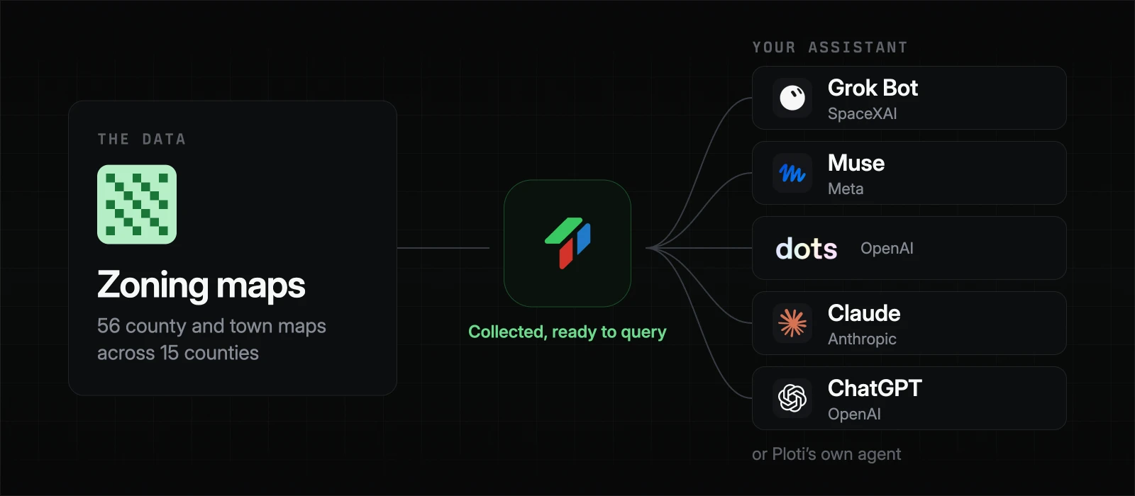
Most of the speed came from work already done. 38 of the 56 maps were in Ploti before the investor asked, because Ploti keeps collecting zoning in the places it covers; the other 18 were sourced fresh that night. In the New Mexico county, the public map showed parcels and roads but no zoning at all. Ploti's agents searched the county's own map server, found a zoning layer that was never linked from the public site, and saved the county's zoning ordinance alongside it.
Each map was fetched once and stays ready. The investor's assistant can check any parcel against every district in all 15 counties at once, as often as it needs to, through an MCP connector in Claude or ChatGPT, or through Ploti's own agent. When a town keeps its zoning map off the web, Ploti can email the town and handle the back-and-forth, and the same agents work through permit portals and meeting archives when a screen needs more than zoning.
Why not buy zoning data from a data provider
National zoning products exist. They are usually sold on annual contracts negotiated through sales, often in the tens of thousands of dollars, with access priced by seat, export, or lookup, and coverage of small towns varies. A 25-county screen tends to run into all of those limits at once.
Ploti works differently:
- No contract. Sign up yourself and start with a 7-day trial.
- Pay for the counties you screen. Pricing is per county and gets cheaper as you add more: all 25 counties in this screen come to $750 a month.
- Full access in your counties. Your assistant can query every zoning district in your coverage areas, town maps included, rather than a capped number of lookups.
- It fills in ahead of you. Ploti keeps collecting data in your counties on its own. In this request, two out of three maps were already there before the investor asked.
What else it unlocks
With zoning in place, the rest of the screen can build on it:
- Infill versus rural. Sort every lot in a county by whether it sits in a town district or rural county zoning, and which districts allow the lot sizes and uses you want.
- The rest of the buy box. The same investor asked for utilities and tax delinquency in each county. Paired with zoning, that becomes a list of buildable lots near water and sewer with owners who are behind on taxes.
- Which counties to work in. With the same maps in every county you are weighing, you can compare how much land in each is zoned the way you need before you visit any of them.
For more on how this fits together, see what a real estate data layer for AI is. Anything your screen needs that is not in Ploti yet, you can ask for as a data request.
Frequently asked questions
Where can I find the zoning map for a county?
Start with the county's planning or GIS department, which maps zoning for unincorporated land. Each incorporated city or town keeps its own zoning map, usually on its own website or map server, and some publish it only as a PDF.
Why does one county have more than one zoning map?
Cities and towns set their own zoning inside their limits. In one coastal North Carolina county, the county and 19 towns each have their own map, so screening land there means collecting 20 maps.
How long does it take to collect zoning for several counties?
By hand, often about an hour per government to find the current map, download it, and check it. Ploti delivered 56 zoning datasets across 15 counties for one investor, 11 of the counties within about an hour of the request.
Can an AI assistant check zoning for land I am looking at?
Yes, once it can query the zoning data. Connect Claude, ChatGPT, or another assistant to Ploti with an MCP connector and ask what a parcel is zoned in any of your counties, or ask Ploti's own agent.
How you can do it yourself
If you already work in an assistant, connect Ploti and run your own screen. Setup takes about two minutes for Claude, ChatGPT, Gemini, Claude Code, Codex, and Cursor, and works with any assistant that supports MCP connectors. Then ask questions like:
- "Which parcels over five acres in my counties are zoned for single-family residential?"
- "For this list of lots, which sit inside a town's zoning and which are in rural county zoning?"
- "In each of my counties, what share of vacant land allows lots under one acre?"
If you don't use an assistant, ask Ploti's agent on the web, in the Mac or Windows app, or soon on your phone. Pick the counties you are screening and start a 7-day trial.