This example uses regional datasets (Orange County wetlands) in addition to national data (FEMA flood zones). Wetland screening is available in areas where we’ve integrated local environmental data. Learn more about regional data coverage.
The Opportunity
Environmental screening helps you:- Find sites without fatal flaws before investing time in due diligence
- Identify clean development parcels in a single query
- Screen out properties with flood insurance requirements or wetland permitting
- Focus your efforts on the most developable land
Walkthrough: Finding Clean Development Sites
Let’s find vacant land over 5 acres with no flood zone exposure and no wetlands—the “easy” sites that won’t require environmental mitigation.Step 1: Select Your Search Area
First, select the boundary you want to search within.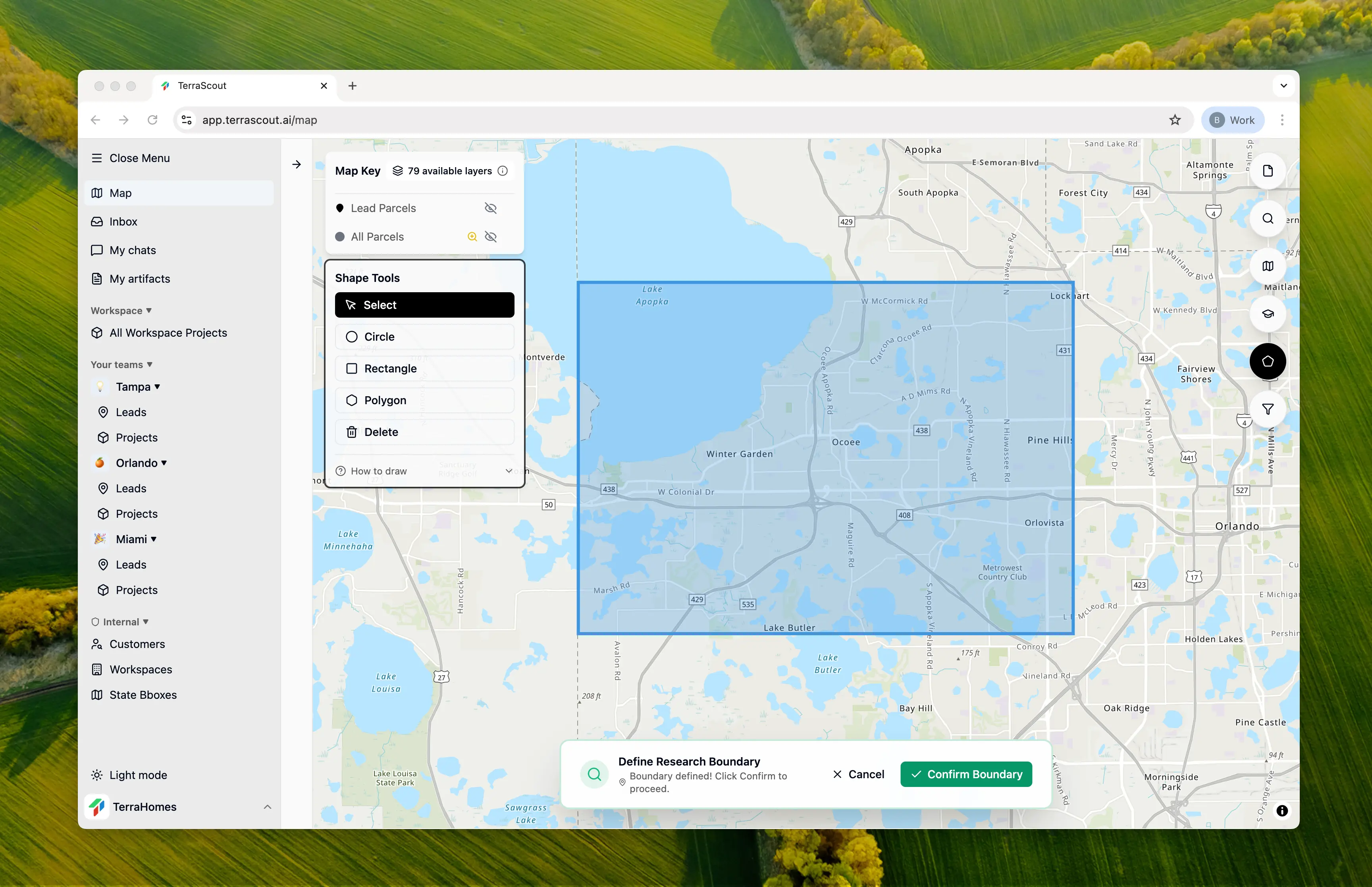
Step 2: Ask the Question
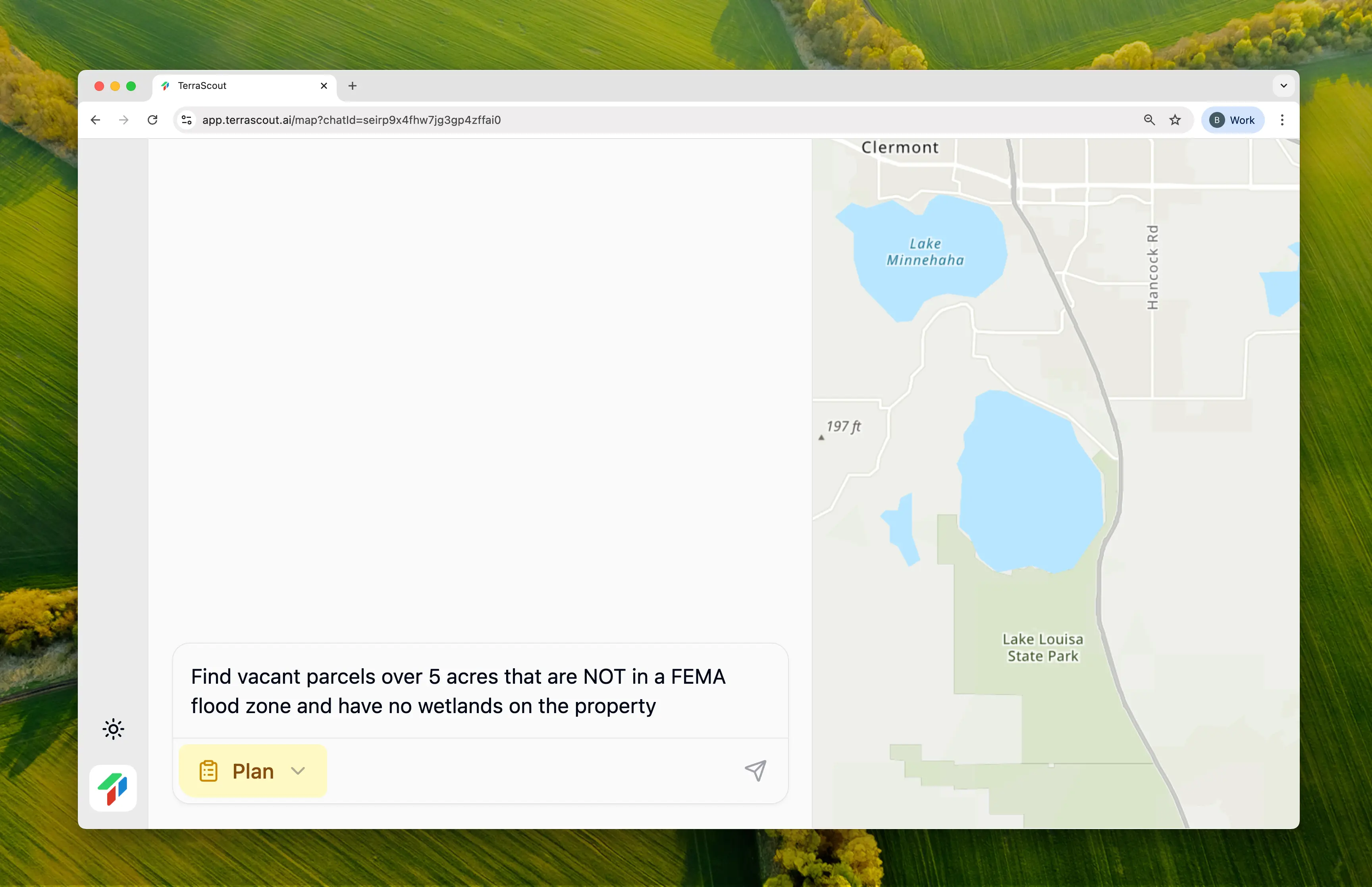
Find vacant parcels over 5 acres that are NOT in a FEMA flood zone and have no wetlands on the propertyThis query combines negative filtering across multiple layers:
- Vacant land (no improvements)
- 5+ acres (meaningful development size)
- NOT in flood zone (exclude FEMA Special Flood Hazard Areas)
- No wetlands (exclude parcels intersecting wetland polygons)
Step 3: Review the Plan
Ploti analyzes your request and creates a multi-layer analysis plan: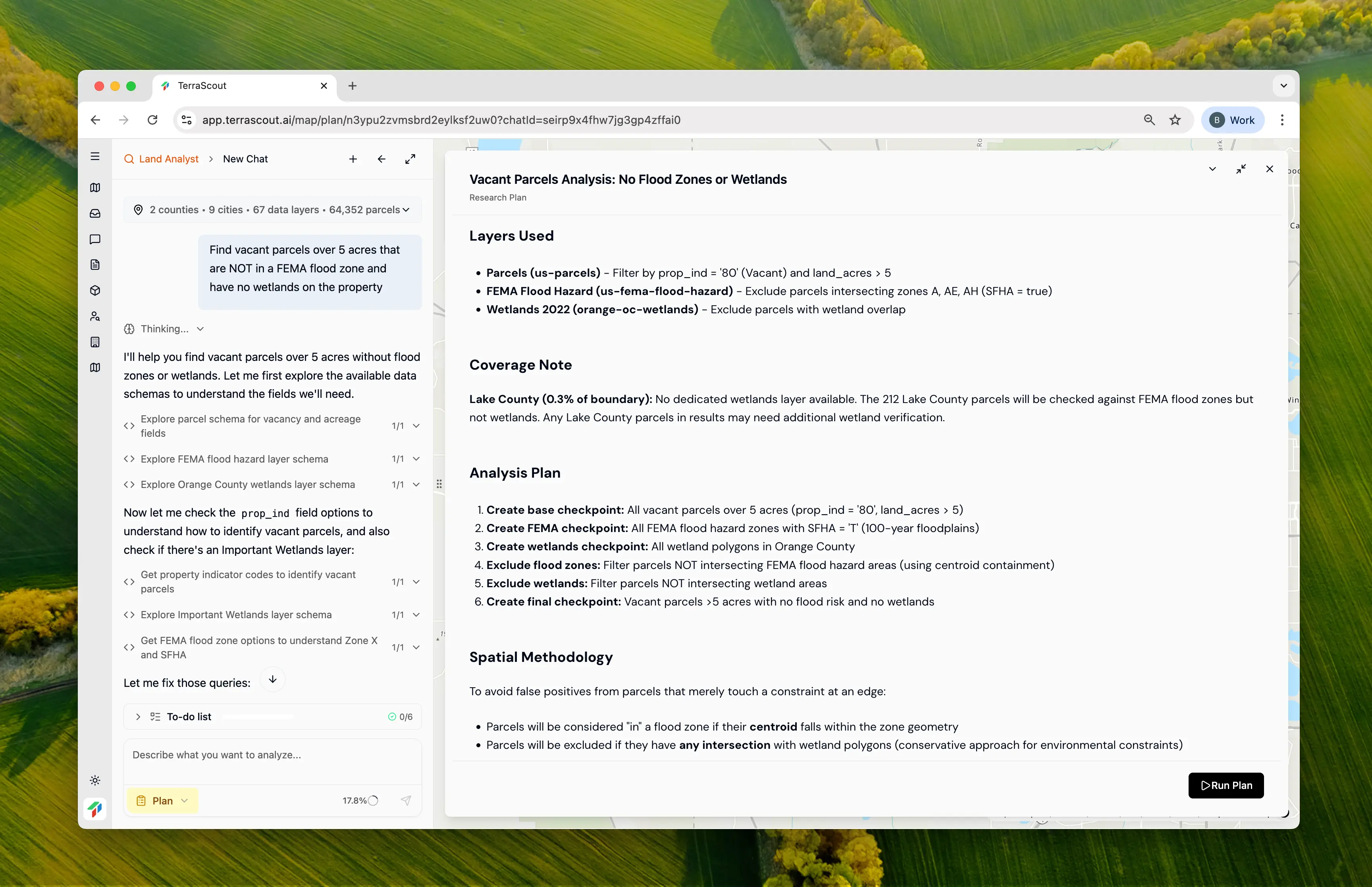
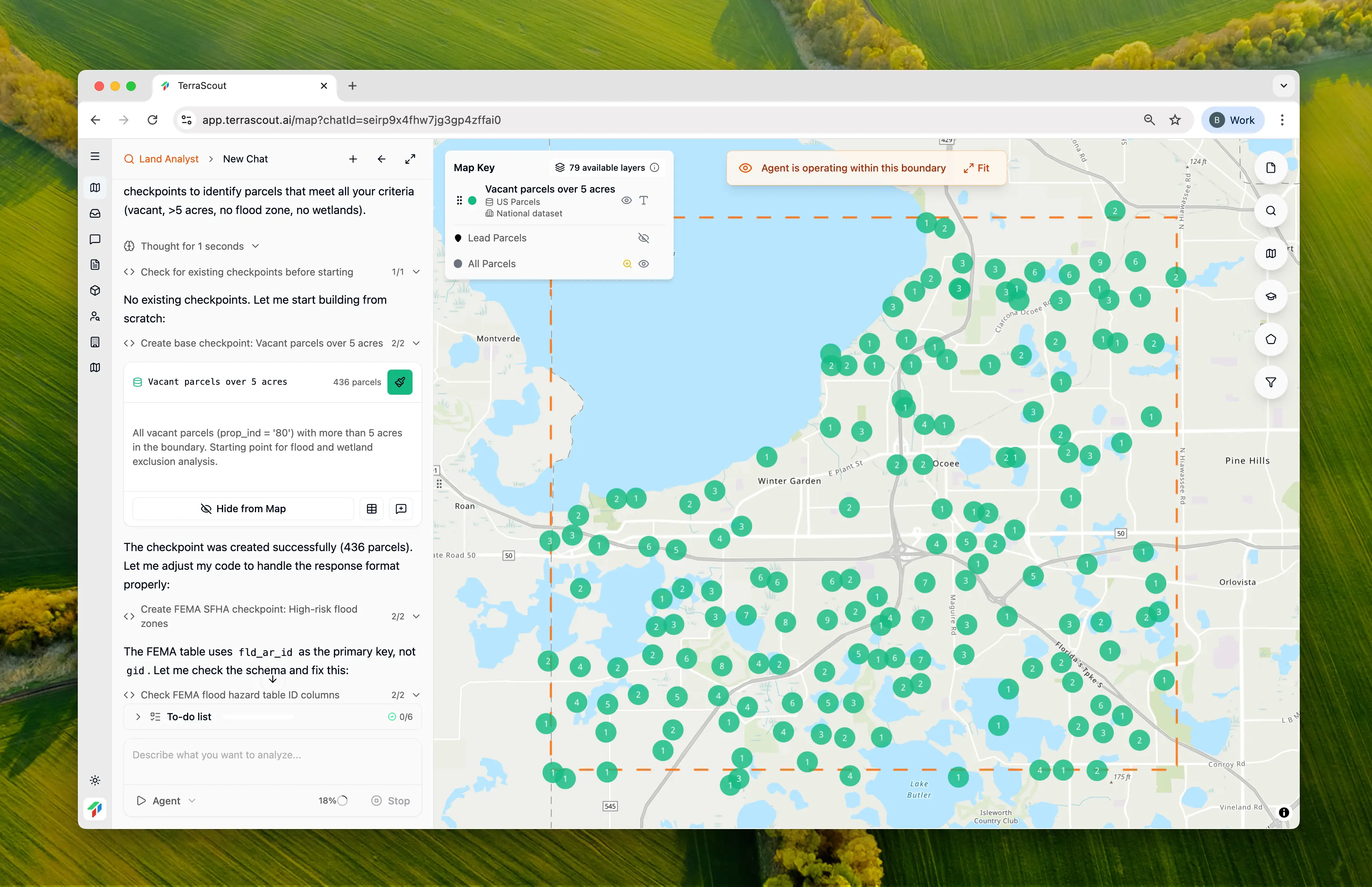
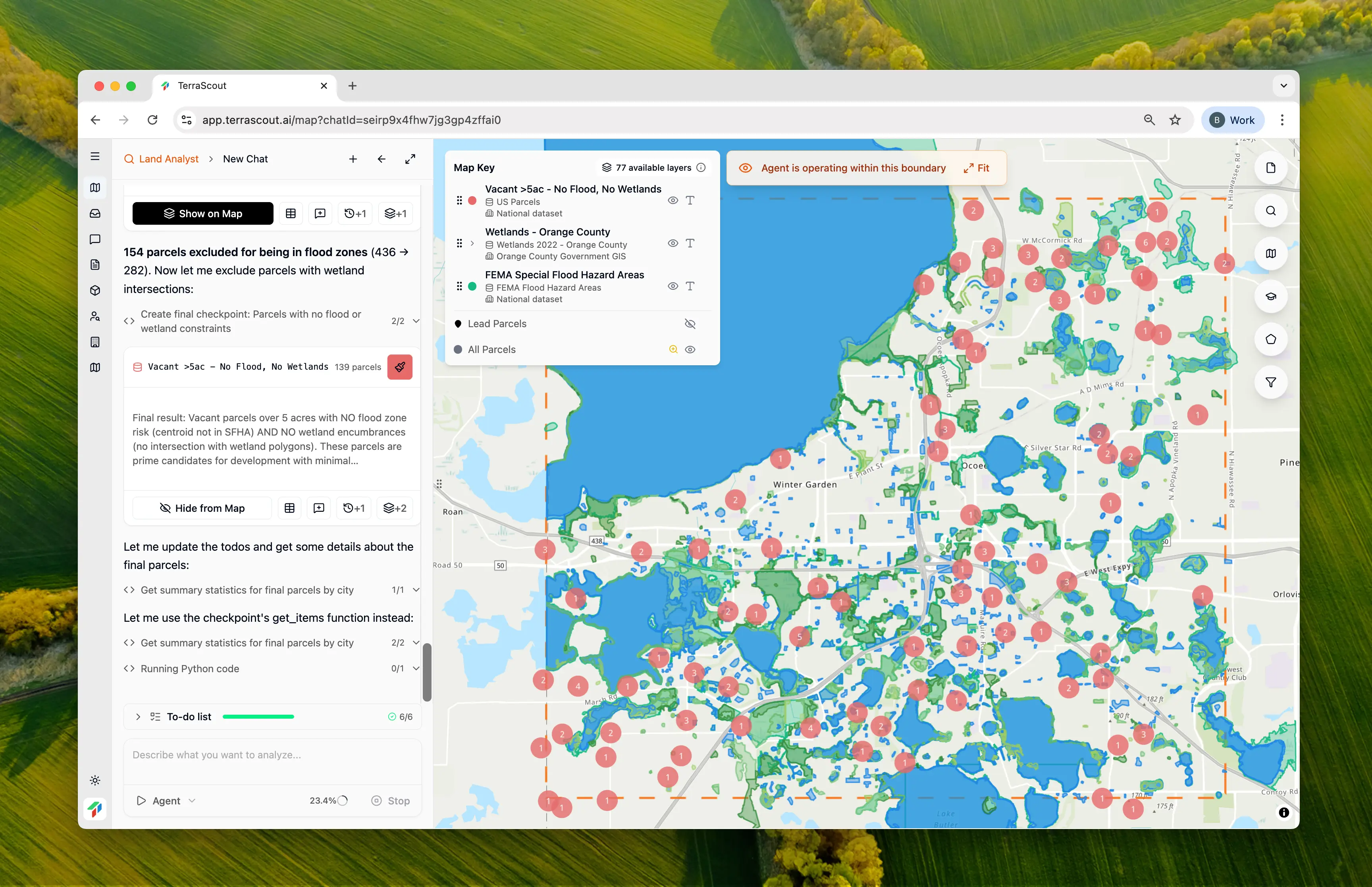
- 436 vacant parcels over 5 acres as the starting point
- 363 FEMA flood zone polygons to check against
- 1,871 wetland polygons from the county wetlands layer
Step 4: See the Starting Point
Step 5: Final Results with Environmental Exclusions
| Stage | Parcels | Removed |
|---|---|---|
| Starting: Vacant >5 acres | 436 | — |
| After flood zone exclusion | 282 | -154 (35%) |
| After wetland exclusion | 139 | -143 (33%) |
Step 6: Analyze the Summary
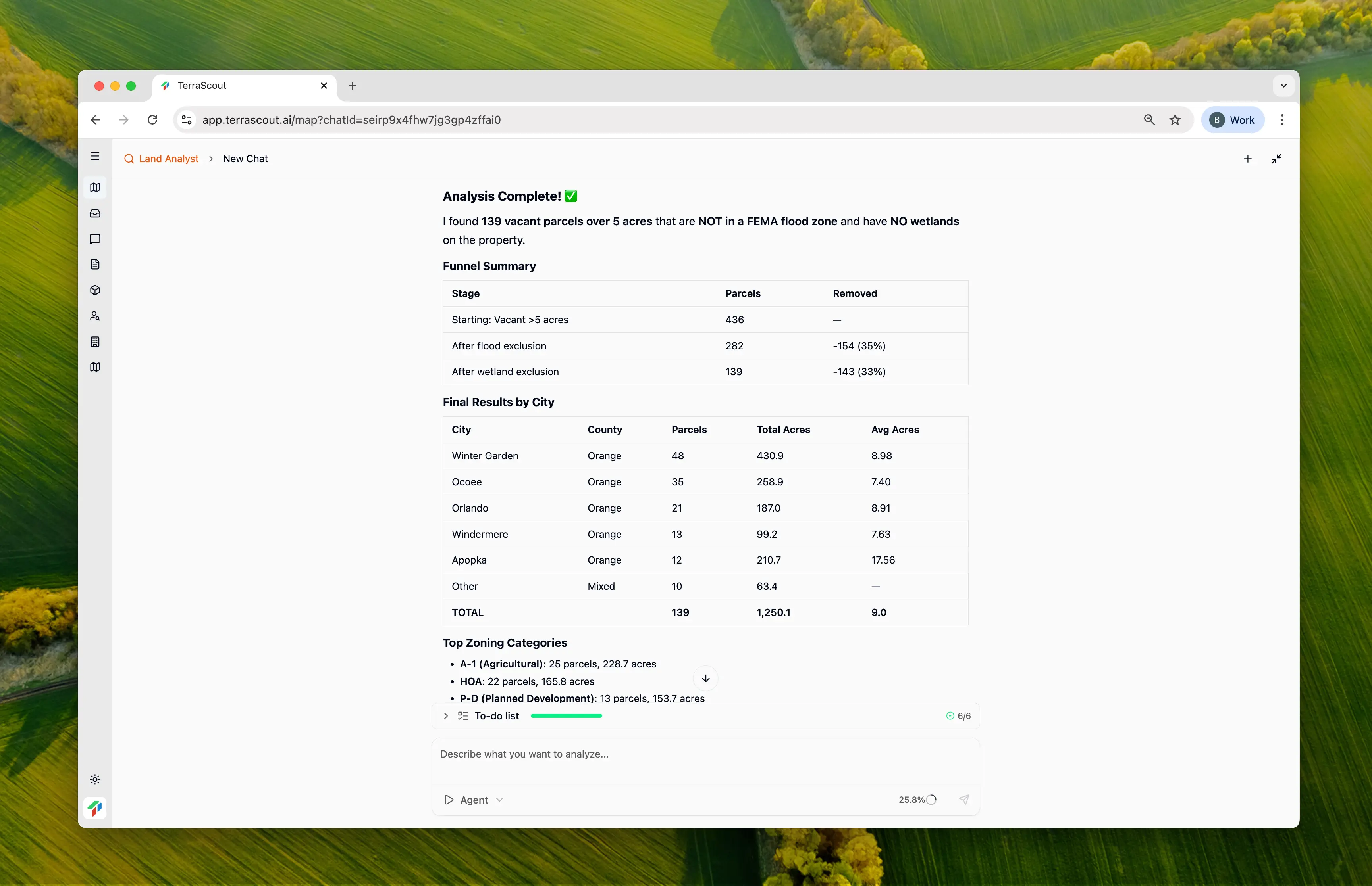
| City | Parcels | Total Acres | Avg Size |
|---|---|---|---|
| Winter Garden | 48 | 430.9 | 8.98 acres |
| Ocoee | 35 | 258.9 | 7.40 acres |
| Orlando | 21 | 187.0 | 8.91 acres |
| Windermere | 13 | 99.2 | 7.63 acres |
| Apopka | 12 | 210.7 | 17.56 acres |
Step 7: Toggle Supporting Layers
One powerful feature: Ploti shows the environmental layers it used for exclusion. Toggle them on to visualize what you’re avoiding: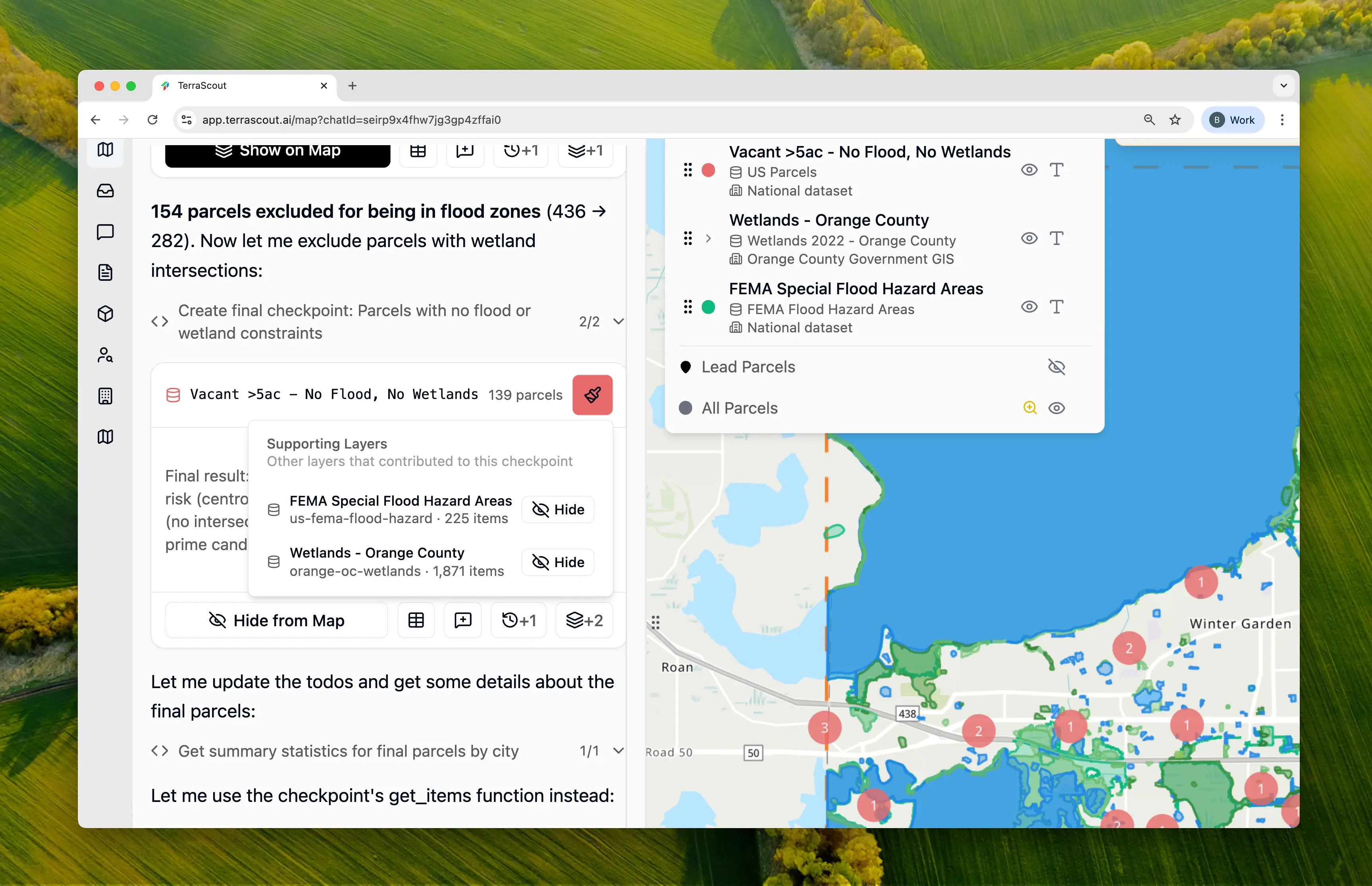
- FEMA Special Flood Hazard Areas (225 zones in your boundary)
- Wetlands (1,871 polygons)
Why Multi-Layer Analysis Matters
This search combined data from three different sources:- Parcel data (property characteristics)
- FEMA flood hazard data (federal flood maps)
- County wetlands data (local environmental data)
The Time Savings
Without Ploti, this analysis would require:- Downloading parcel data and filtering for vacant land >5 acres
- Obtaining FEMA flood maps and importing into GIS
- Obtaining county wetlands shapefiles
- Writing spatial queries to identify parcel-flood zone intersections
- Writing spatial queries to identify parcel-wetland intersections
- Combining exclusions and generating final list
- Creating summary statistics by location
Tips
- Desktop screening isn’t a substitute for Phase I environmental assessment—always verify before closing
- Wetland boundaries need field verification; mapped boundaries are approximate
- Consider proximity to constraints, not just intersection—a parcel adjacent to wetlands may still have permitting issues
- Some flood zone issues can be resolved with elevation certificates or LOMA applications
- Toggle on the supporting layers to understand the environmental context around your target parcels
Other Example Prompts
Flood Zone Analysis Only
Find vacant parcels over 10 acres that are completely outside any FEMA flood zoneSimpler screen focusing only on flood risk.
Wetland Impact Assessment
How much of this parcel is covered by wetlands?Check a specific parcel for wetland percentage before making an offer.
Conservation Area Screen
Find vacant parcels over 5 acres that don’t intersect any preservation districts or conservation easementsScreen for conservation restrictions that may limit development.
Comprehensive Environmental Screen
Check this parcel for flood zones, wetlands, and soil typesGet a complete environmental picture for due diligence on a specific property.