The Opportunity
Assemblage opportunities are hidden in plain sight:- A 20-acre development site might be three 7-acre parcels that don’t show up in a “15+ acre” search
- Owners with multiple adjacent parcels are often motivated to sell as a package
- Same-owner assemblages mean one negotiation, not three
- These opportunities are invisible to anyone using traditional parcel searches
Walkthrough: Finding Same-Owner Assemblages
Let’s find vacant parcels where the same owner controls 3 or more adjacent parcels totaling over 20 acres—development-ready sites that would never appear in a standard acreage filter.Step 1: Select Your Search Area
First, select the boundary you want to search within.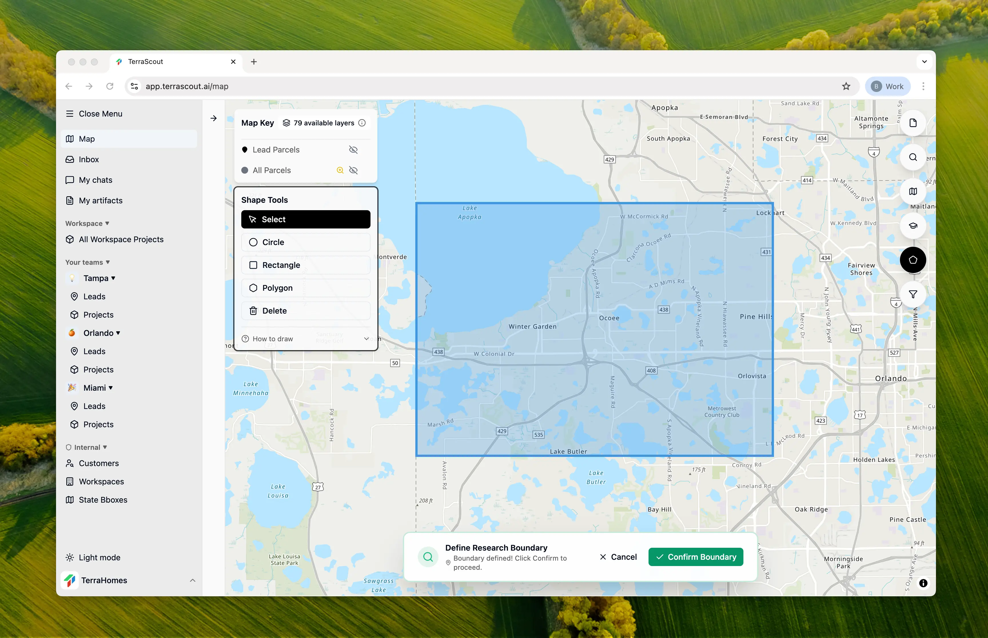
Step 2: Ask the Question
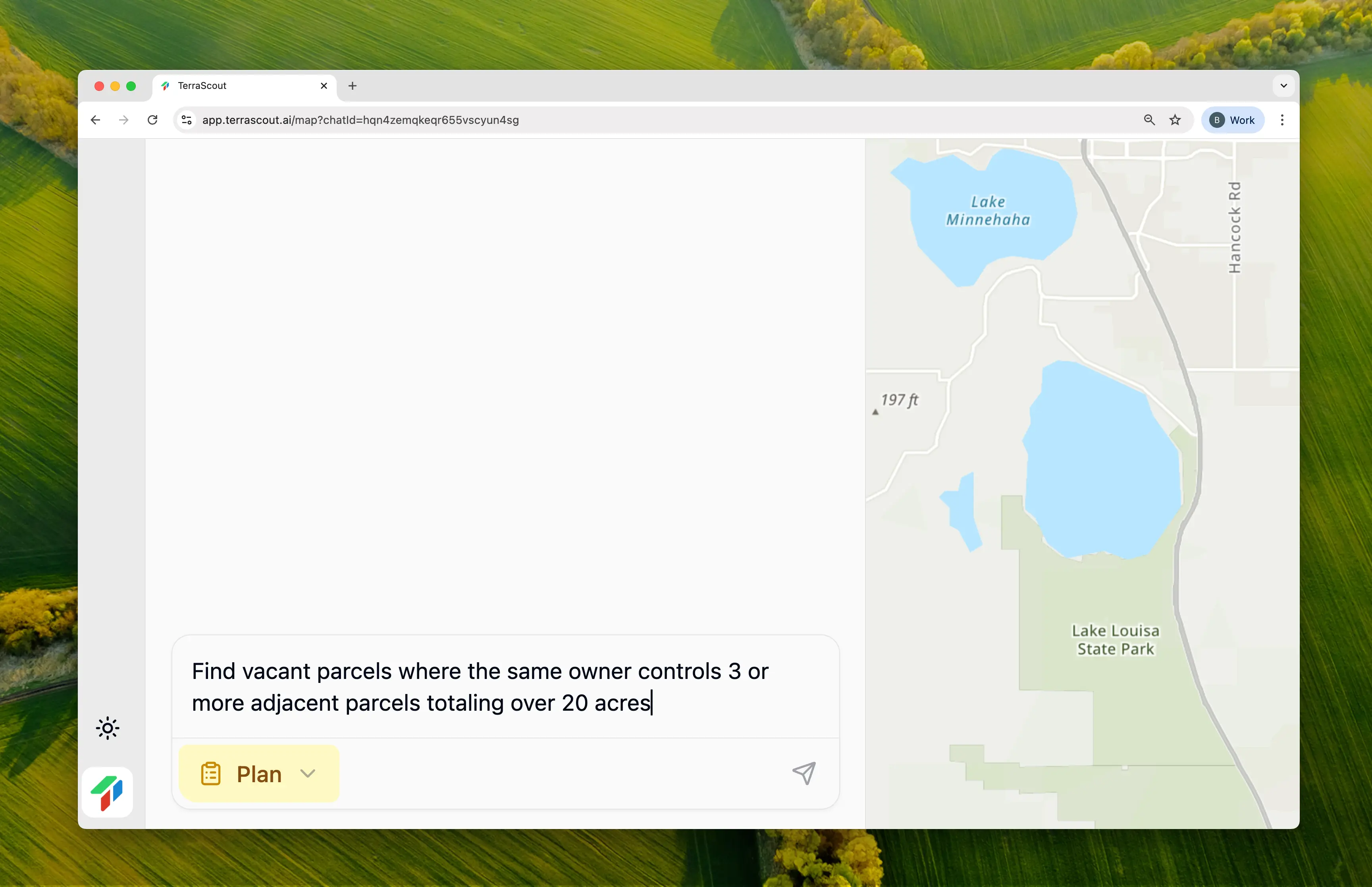
Find vacant parcels where the same owner controls 3 or more adjacent parcels totaling over 20 acresThis request requires something no simple filter can do:
- Spatial adjacency detection — which parcels physically touch?
- Ownership grouping — which adjacent parcels share an owner?
- Combined acreage calculation — what’s the total when grouped?
- Threshold filtering — which groups meet 3+ parcels AND 20+ acres?
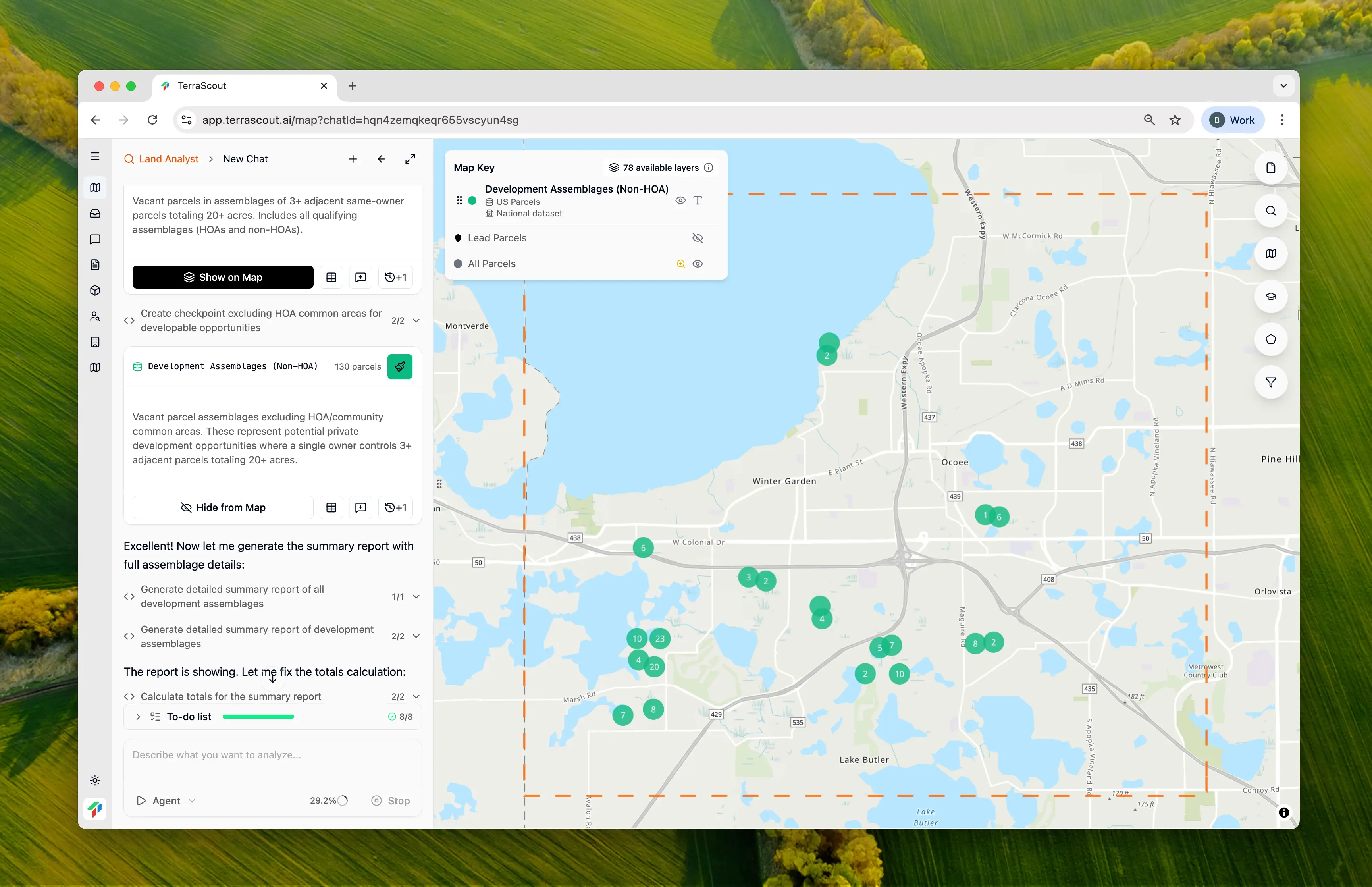
Step 3: Review the Analysis Plan
Ploti creates a plan usingST_ClusterDBSCAN spatial clustering to identify connected groups of parcels:

Step 4: Review the Results
| Owner | Parcels | Total Acres | Location | Zoning |
|---|---|---|---|---|
| Orange County BCC | 5 | 68.87 | Winter Garden | A-1, R-1 |
| Toll Southeast Company Inc | 3 | 57.99 | Winter Garden | P-D |
| Raymer F Maguire | 3 | 39.46 | Winter Garden | PUD |
| Lake Bennett Village-Ocoee LLC | 4 | 30.84 | Ocoee | A-1 |
| Maine Blvd LLC | 3 | 27.49 | Ocoee | R-3 |
| Toll Southeast Company Inc | 5 | 26.69 | Windermere | R-CE |
Step 5: Explore an Assemblage
Click any parcel to see the full assemblage. Here’s a cluster of 5 adjacent parcels under common ownership: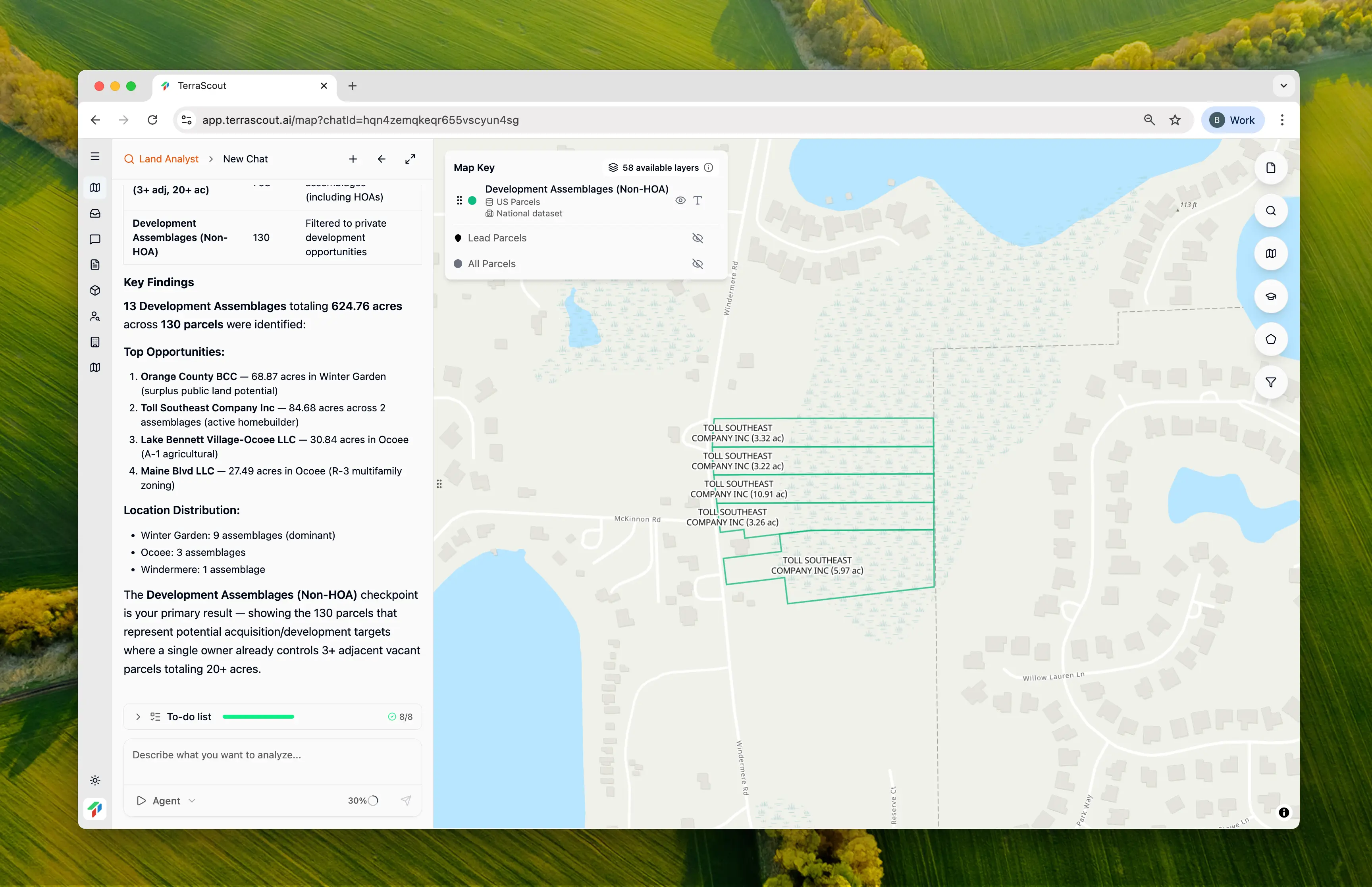
Why This Matters
This analysis is literally impossible with standard GIS tools. Traditional platforms let you filter parcels by size, zoning, or owner name. But finding adjacent parcels under common ownership that together meet a size threshold? That requires:- Loading every parcel’s geometry
- Running spatial intersection algorithms to find adjacencies
- Grouping parcels by owner
- Calculating combined acreage per group
- Filtering groups by parcel count and total size
The Time Savings
Without Ploti, finding these 13 assemblages would require:- Exporting all 4,791 vacant parcels with geometries
- Loading into QGIS or ArcGIS Pro
- Writing a Python script to detect adjacent parcels using spatial joins
- Joining ownership data and grouping by owner
- Calculating combined acreage for each group
- Filtering for 3+ parcels and 20+ acres
- Exporting results and cross-referencing with source data
Leveling the Playing Field
Here’s the real story: this type of spatial analysis has historically been available only to institutional investors and large developers with dedicated GIS teams. A regional homebuilder or local investor looking at the same county would run a simple “20+ acre vacant” search and find maybe 50 parcels. They’d never see the 130 parcels across 13 assemblages that Ploti surfaced—because each individual parcel is too small to trigger the filter. The institutional player with a GIS team? They’d find them. They’d reach out to Maine Blvd LLC about their 27-acre R-3 assemblage before anyone else knew it existed. Ploti gives everyone access to institutional-grade spatial analysis. The playing field is level.Tips
- Same-owner assemblages mean one negotiation—much easier than multi-party deals
- Look for assemblages where the owner has held for 10+ years—often more motivated
- Check that all parcels in an assemblage have compatible zoning
- Owners with multiple parcels may offer package discounts to simplify their exit
- County-owned assemblages (like Orange County BCC above) may be surplus land available for sale
Other Example Prompts
Larger Assemblages
Find same-owner assemblages where one owner controls 5+ adjacent vacant parcels totaling 50+ acresFor major subdivision opportunities.
Long-Term Holder Assemblages
Find vacant parcels where the same owner controls 2+ adjacent parcels totaling 15+ acres and hasn’t sold in 10 yearsCombines assemblage detection with motivated seller signals.
Zoning-Specific Assemblages
Find adjacent vacant parcels under common ownership totaling 20+ acres that are zoned for multifamilyTarget specific development types.