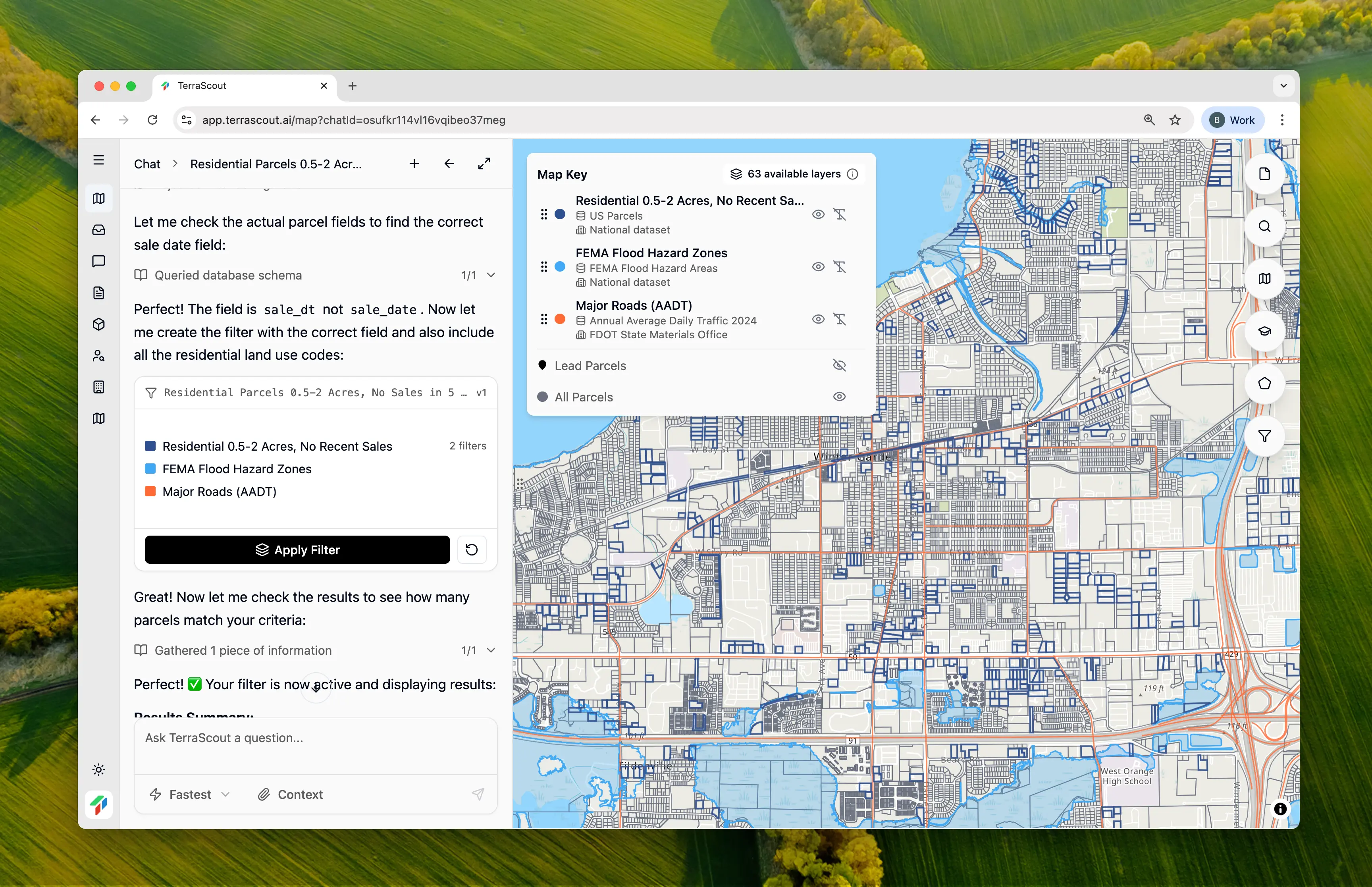
How It Works
Each area on the map has different data layers available. When you ask Ploti to show you something, it checks the available layers and creates the appropriate filter.- “Show me residential parcels over 5 acres”
- “Find vacant land zoned for multifamily”
- “I need parcels with no structures that are at least 2 acres”
Filters Follow You
Once a filter is applied, it stays active as you move around the map. Pan to a different area and the same filter applies there too. Some layers are county-specific or region-specific. If you move outside an area where a layer is supported, Ploti will let you know.Manual Control When You Want It
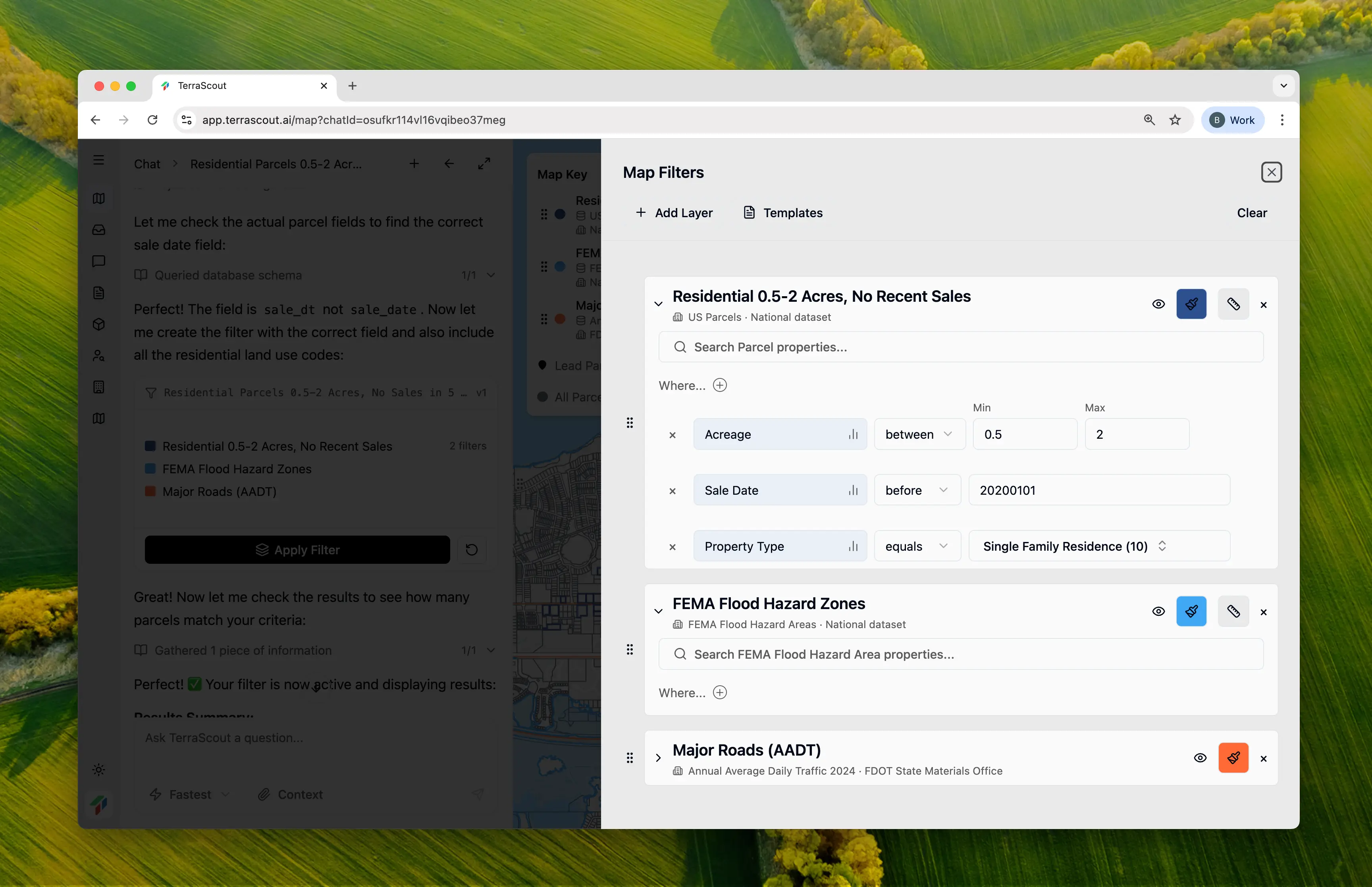
- “Change the minimum lot size to 3 acres”
- “Add a filter for parcels with road frontage”
- “Remove the zoning filter”
Multiple Layers of the Same Type
Most GIS platforms only support one layer per entity. For example, you can only have one parcel layer, which means you can only filter for one thing at a time. Ploti lets you create unlimited layers of the same type. Want to see residential parcels over 5 acres in blue and commercial parcels in red at the same time? Add two parcel layers with different filters and colors. This lets you build custom map keys to visualize what’s happening in an area:- Color-code parcels by zoning type
- Highlight high-value targets in one color, secondary targets in another
- Show multiple filter criteria simultaneously