> ## Documentation Index
> Fetch the complete documentation index at: https://terrascout.ai/docs/llms.txt
> Use this file to discover all available pages before exploring further.
# Ploti MCP
> Bring Ploti real estate research data, ordinance research, and maps into your AI assistant
# Use Ploti from the assistant you already know
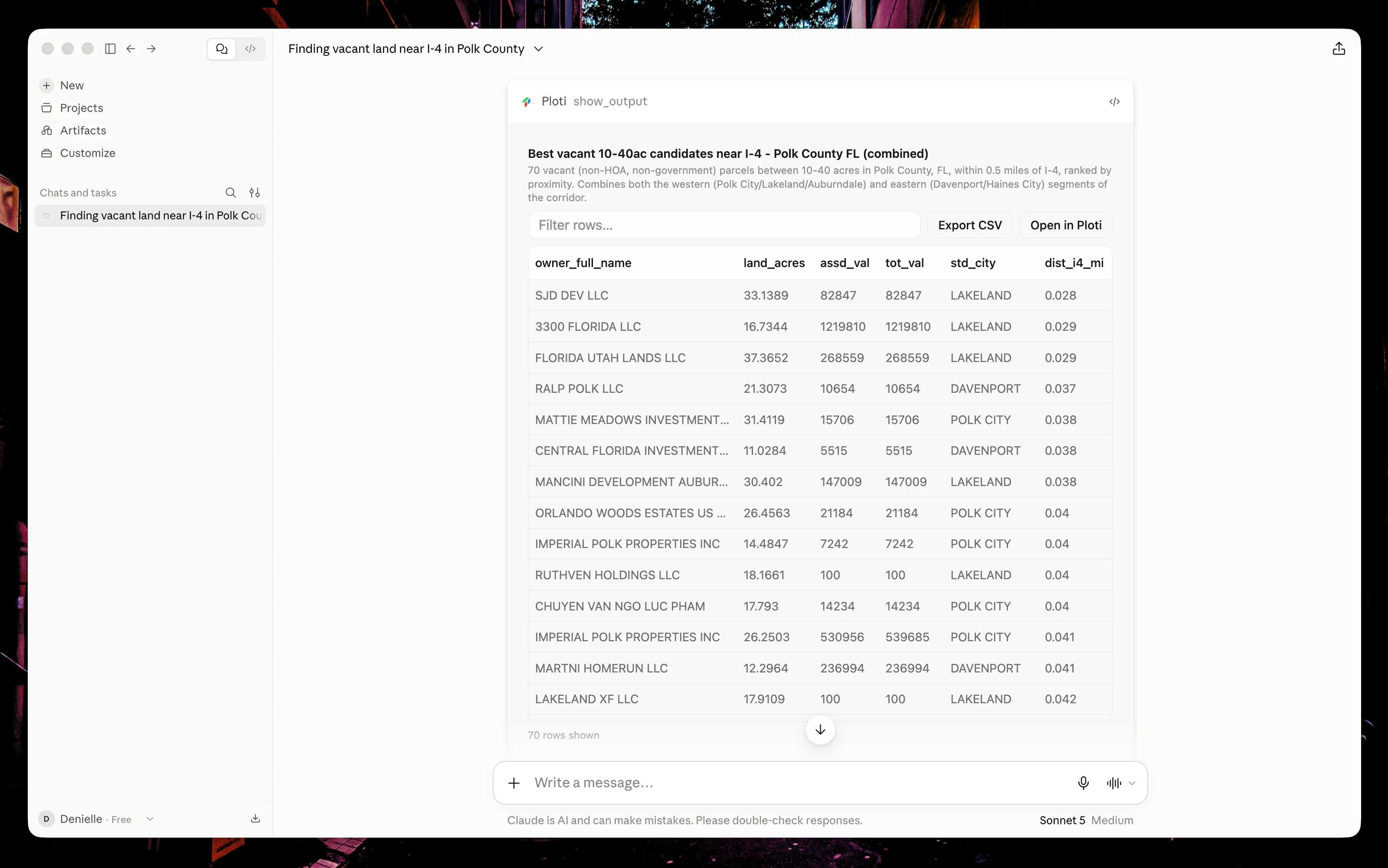
Ploti's remote Model Context Protocol (MCP) server gives compatible AI assistants controlled access to focused real estate research tools. Ask a question in Claude, ChatGPT, Gemini, Cursor, Claude Code, or Codex; your assistant can search the right area, analyze the available data, and return a map, table, or file without making you copy information between products.
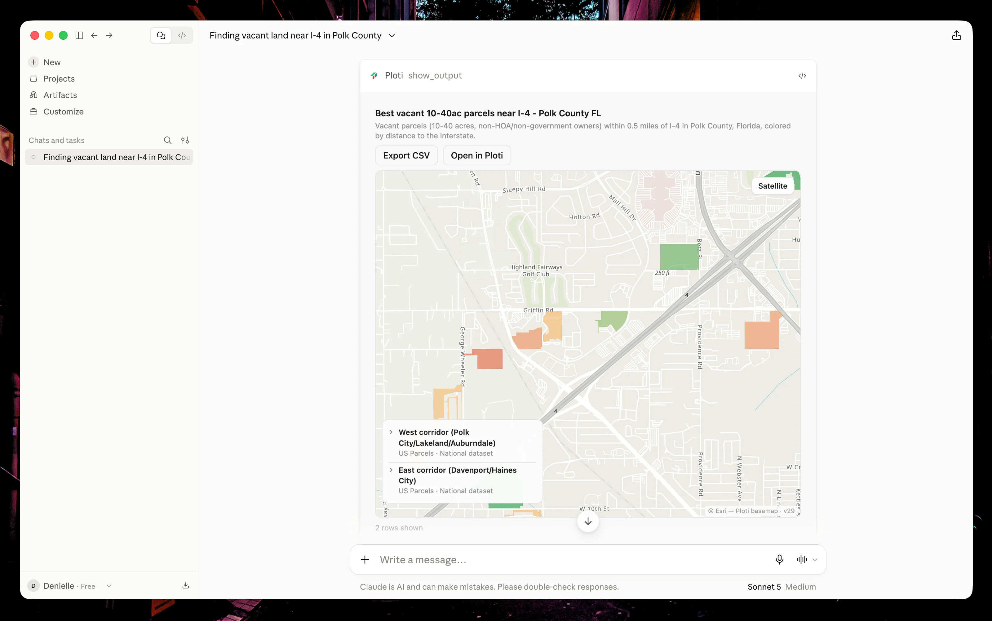 Ask for a comparison table to review the candidates' attributes. Map and table outputs can appear as separate panels in the conversation.
 ## What you can do
Search parcels in a named place, filter by property attributes, compare
candidates, and inspect the result on a map.
Ask questions about zoning and municipal codes and receive source-backed
answers when coverage is available.
Combine parcel data with available zoning, flood, environmental,
transportation, and other map layers.
Save checkpoints, live filters, tables, queries, maps, and downloadable
files to your Ploti workspace.
## How it works
Add `https://mcp.ploti.ai/api/mcp` as a remote MCP server in your assistant.
Ploti uses OAuth, so you never paste your Ploti password or an API key into
the assistant.
Sign in to Ploti, choose a workspace, and approve the connection. The
assistant receives access only to that workspace through your Ploti account.
Describe the place, property criteria, or ordinance question. Your assistant
decides which Ploti tools to use and reports what it is doing.
Inspect a concise result in the conversation, open the interactive map or
table, or continue the same work in Ploti.
## Choose your assistant
Claude on web or desktop
ChatGPT apps and connectors
Gemini app or Gemini CLI
Cursor Agent
Anthropic's terminal agent
Codex app, CLI, and IDE extension
## Plans and data access
Free Ploti MCP workspaces can use nationwide U.S. parcel data and ordinance research. Paid workspaces can also query the additional datasets available in the current map area. Ploti tells the assistant which layers are available before it runs an analysis; it does not silently substitute a locked dataset.
Your assistant provider may require a paid plan or developer setting to use custom MCP servers. See the guide for your assistant for current setup requirements.
Ploti supports research and analysis. Property records and municipal sources
can be incomplete or change over time, so verify important facts with the
cited source or appropriate authority before making a decision.
## Next steps
Start with tested, realistic property and ordinance workflows.
Understand authorization, workspace boundaries, retention, and revocation.
## What you can do
Search parcels in a named place, filter by property attributes, compare
candidates, and inspect the result on a map.
Ask questions about zoning and municipal codes and receive source-backed
answers when coverage is available.
Combine parcel data with available zoning, flood, environmental,
transportation, and other map layers.
Save checkpoints, live filters, tables, queries, maps, and downloadable
files to your Ploti workspace.
## How it works
Add `https://mcp.ploti.ai/api/mcp` as a remote MCP server in your assistant.
Ploti uses OAuth, so you never paste your Ploti password or an API key into
the assistant.
Sign in to Ploti, choose a workspace, and approve the connection. The
assistant receives access only to that workspace through your Ploti account.
Describe the place, property criteria, or ordinance question. Your assistant
decides which Ploti tools to use and reports what it is doing.
Inspect a concise result in the conversation, open the interactive map or
table, or continue the same work in Ploti.
## Choose your assistant
Claude on web or desktop
ChatGPT apps and connectors
Gemini app or Gemini CLI
Cursor Agent
Anthropic's terminal agent
Codex app, CLI, and IDE extension
## Plans and data access
Free Ploti MCP workspaces can use nationwide U.S. parcel data and ordinance research. Paid workspaces can also query the additional datasets available in the current map area. Ploti tells the assistant which layers are available before it runs an analysis; it does not silently substitute a locked dataset.
Your assistant provider may require a paid plan or developer setting to use custom MCP servers. See the guide for your assistant for current setup requirements.
Ploti supports research and analysis. Property records and municipal sources
can be incomplete or change over time, so verify important facts with the
cited source or appropriate authority before making a decision.
## Next steps
Start with tested, realistic property and ordinance workflows.
Understand authorization, workspace boundaries, retention, and revocation.